Representation of Geographical Features — Chapter Summary
ICSE · Class 8 · Geography
Summary of Representation of Geographical Features for ICSE Class 8 Geography. Part of the ICSE Class 8 Geography syllabus.
Interactive on Super Tutor
Studying Representation of Geographical Features? Get the full interactive chapter.
Quizzes, flashcards, AI doubt-solver and a step-by-step study plan — built for chapter summary and more.
Free trial, no card needed.
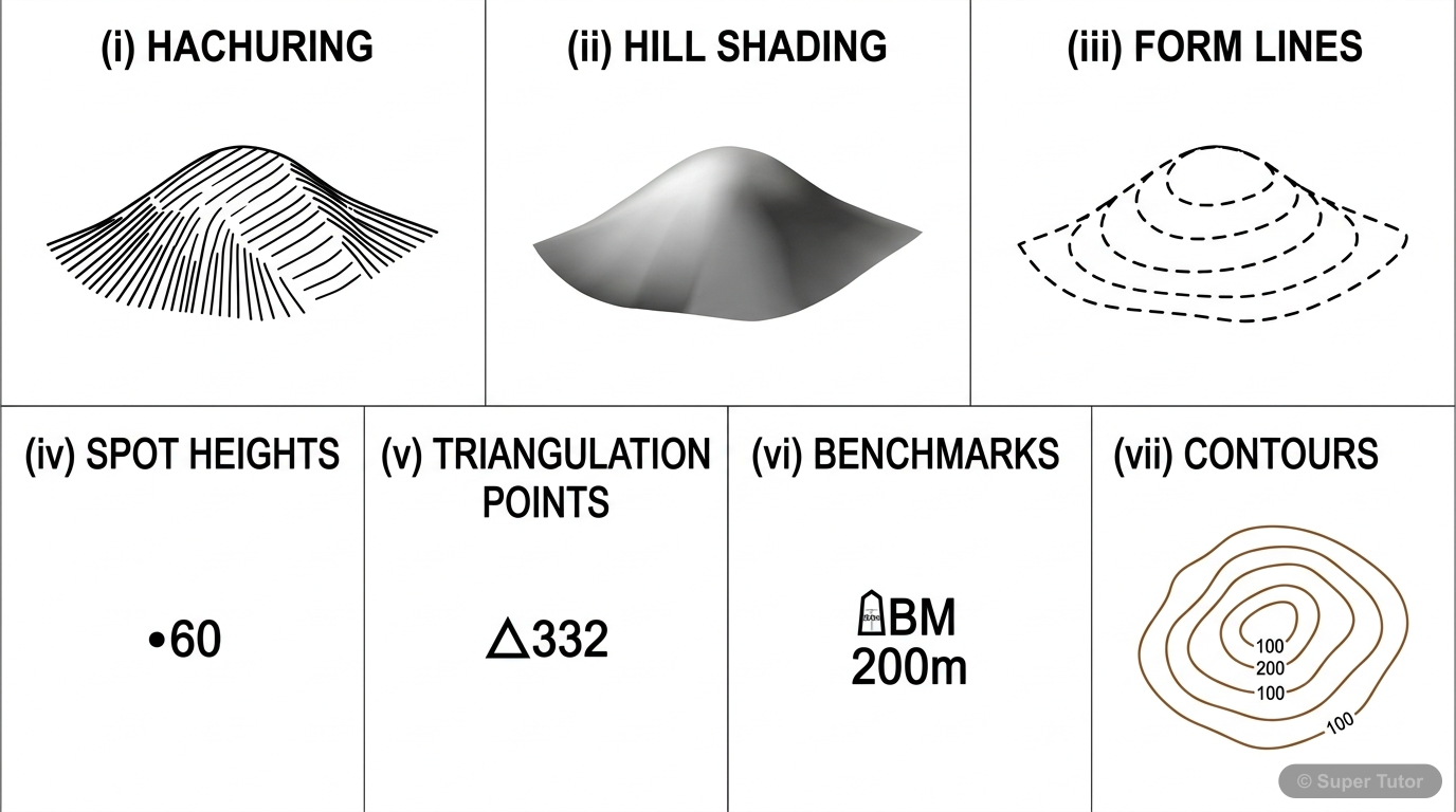
Learn better with visuals Super Tutor pairs illustrations like this with notes and quizzes for Representation of Geographical Features.
Overview
Topographical sheets show the shape of the land and the features on it by using contours, symbols, and colours. Relief is represented through methods such as hachuring, hill shading, form lines, spot heights, triangulation method, and bench marks. Contours are especially important because they show
Key Concepts
A contour line is an imaginary
A contour line is an imaginary line joining all places which are at the same height above sea level. Contours on ordnance survey maps of 1:50,000 scal
Every fifth contour line
Every fifth contour line, at multiples of 20 m, is shown more clearly to make the contour map distinct.
Closely spaced contours show a steep
Closely spaced contours show a steep slope, while widely spaced contours show a gentle slope.
A conical hill is shown by
A conical hill is shown by closed, almost circular contours with uniform spacing.
A watershed ridge is a hilly
A watershed ridge is a hilly ridge rising over 100 m. The western slope is steep and is called the Scarp Slope, while the eastern slope is gentler and
Learning Objectives
- Understand how physical and human features are shown on topographical maps.
- Read contour lines and use them to identify height and slope.
- Recognise landforms such as hills, ridges, plateaus, cliffs, waterfalls, passes, saddles, cols, and gaps.
- Distinguish between steep and gentle slopes from contour spacing.
- Identify settlement patterns such as nucleated, linear, and scattered settlements.
Frequently Asked Questions
What are the important topics in Representation of Geographical Features for ICSE Class 8 Geography?
How should I revise Representation of Geographical Features for Class 8 exams?
Sources & Official References
Content is aligned to the official syllabus. Refer to the board website for the latest curriculum.
More resources for Representation of Geographical Features
For serious students
Get the full Representation of Geographical Features chapter — start free.
Quizzes, flashcards, an AI doubt solver and a study plan for ICSE Class 8 Geography. Free to start, no card needed.