Chapter 1 of 10
Revision Notes
Representation of Geographical Features — Revision Notes
ICSE · Class 8 · Geography
Representation of Geographical Features revision notes for ICSE Class 8 Geography: 4 topics in quick points. Part of the ICSE Class 8 Geography syllabus.
42 questions36 flashcards5 concepts
Interactive on Super Tutor
Studying Representation of Geographical Features? Get the full interactive chapter.
Quizzes, flashcards, AI doubt-solver and a step-by-step study plan — built for revision notes and more.
Free trial, no card needed.
Super Tutor
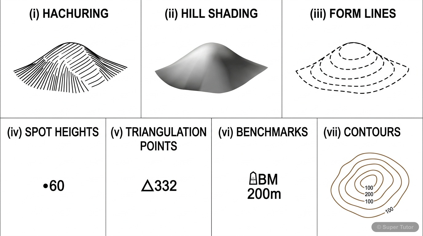
Learn better with visuals Super Tutor pairs illustrations like this with notes and quizzes for Representation of Geographical Features.
Key Topics to Revise
1
Methods of Representing Relief
- Hachuring is a method of showing relief with short lines that indicate the direction of slope.
- Hill shading shows relief by light and shade.
- Form lines are broken contour-like lines used for inaccessible areas and show approximate heights.
2
Contours and Contour Interval
- A contour line is an imaginary line joining all places which are at the same height above sea level.
- The coastline is a simple example of a contour line since it joins all places at sea level.
- Contours are drawn in brown on topographical maps.
3
Landforms Shown by Contours
- A conical hill is shown by closed, almost circular contours with uniform spacing.
- A ridge is a chain of hills or mountains that forms a continuous elevated crest for some distance.
- A watershed ridge is a hilly ridge rising over 100 m.
4
Pass, Saddle, Col, and Gap
- A pass is formed between two hills or mountains and serves as a land route across a mountain range.
- A col is formed between the ridge of a watershed.
- A saddle is a shallow depression between two peaks at higher elevation and has gentle slopes.
Get complete notes with diagrams and examples
Full NotesKey Concepts
A contour line is an imaginaryEvery fifth contour lineClosely spaced contours show a steepA conical hill is shown byA watershed ridge is a hilly
Frequently Asked Questions
What are the important topics in Representation of Geographical Features for ICSE Class 8 Geography?
Key topics in Representation of Geographical Features include Methods of Representing Relief, Contours and Contour Interval, Landforms Shown by Contours, Pass, Saddle, Col, and Gap. Study these first, then practise questions on each for Class 8 exams.
How should I revise Representation of Geographical Features for Class 8 exams?
Learn the core ideas first, then work through the 42 practice questions on Representation of Geographical Features. Revise definitions regularly and use flashcards for quick recall before the exam.
Sources & Official References
Content is aligned to the official syllabus. Refer to the board website for the latest curriculum.
More resources for Representation of Geographical Features
For serious students
Get the full Representation of Geographical Features chapter — start free.
Quizzes, flashcards, an AI doubt solver and a study plan for ICSE Class 8 Geography. Free to start, no card needed.