Representation of Geographical Features — Flashcards
ICSE · Class 8 · Geography
36 flashcards for Representation of Geographical Features (ICSE Class 8 Geography) to test yourself on key terms and facts.
Interactive on Super Tutor
Studying Representation of Geographical Features? Get the full interactive chapter.
Quizzes, flashcards, AI doubt-solver and a step-by-step study plan — built for flashcards and more.
Free trial, no card needed.
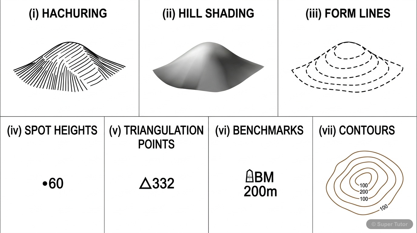
Learn better with visuals Super Tutor pairs illustrations like this with notes and quizzes for Representation of Geographical Features.
What is a contour line?
Answer
A contour line is an imaginary line joining all places which are at the same height above sea level. It is drawn in brown on topographical maps and helps show the shape of the land.
What is the contour interval on 1:50,000 ordnance survey maps?
Answer
The contour interval is 20 m. This means the vertical distance between two adjacent contour lines is 20 m.
Why do contour lines usually not cross each other?
Answer
Contours of different elevation usually do not cross each other because each contour shows places at one exact height above sea level.
What do closely spaced contours show?
Answer
Closely spaced contours show a steep slope. The land rises or falls quickly over a short distance.
What do widely spaced contours show?
Answer
Widely spaced contours show a gentle slope. The land changes height slowly over a longer distance.
What is an index contour?
Answer
An index contour is every fifth contour line, shown more clearly to make the map easier to read. On 1:50,000 maps, it appears at multiples of 100 m.
What is a conical hill in contour form?
Answer
A conical hill is shown by closed, almost circular contours with uniform spacing between them. This shape shows a hill rising evenly from all sides.
How is a plateau shown in contours?
Answer
A plateau is shown by contours leaving a wide gap in the centre, which indicates flat land on top. The low contours show the elevation around it.
+28 more flashcards
Practise AllFrequently Asked Questions
What are the important topics in Representation of Geographical Features for ICSE Class 8 Geography?
How many flashcards are available for Representation of Geographical Features?
How should I revise Representation of Geographical Features for Class 8 exams?
Sources & Official References
Content is aligned to the official syllabus. Refer to the board website for the latest curriculum.
More resources for Representation of Geographical Features
Practice Quiz
Test yourself with a quick quiz
Important Questions
Exam-style questions with answers
Revision Notes
Key points for last-minute revision
Chapter Summary
Understand the chapter at a glance
Concept Maps
See how topics connect
Study Plan
Step-by-step plan for this chapter
Syllabus
What topics to cover
For serious students
Get the full Representation of Geographical Features chapter — start free.
Quizzes, flashcards, an AI doubt solver and a study plan for ICSE Class 8 Geography. Free to start, no card needed.