Representation of Geographical Features — Important Questions
ICSE · Class 8 · Geography
42 important questions from Representation of Geographical Features for ICSE Class 8 Geography, with answers. Includes multiple choice questions.
Interactive on Super Tutor
Studying Representation of Geographical Features? Get the full interactive chapter.
Quizzes, flashcards, AI doubt-solver and a step-by-step study plan — built for important questions and more.
Free trial, no card needed.
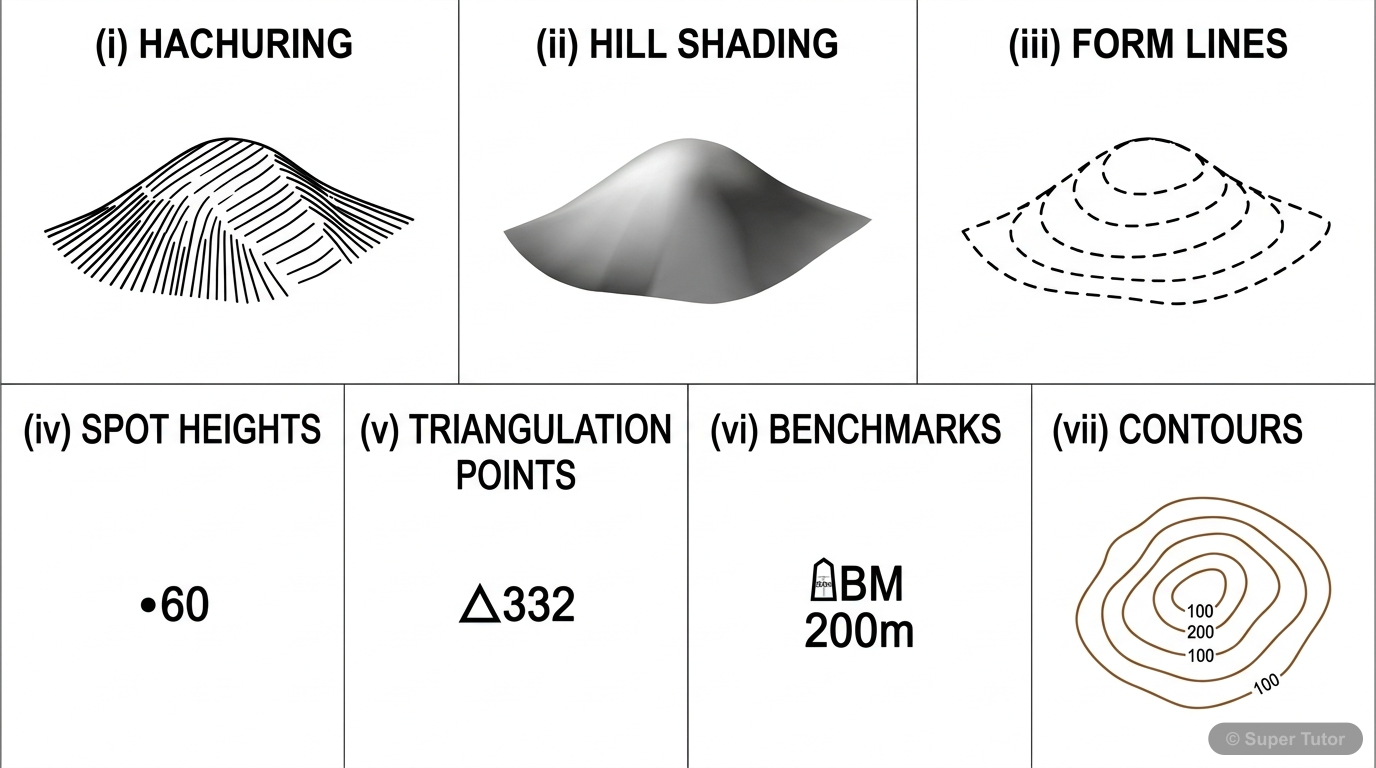
Learn better with visuals Super Tutor pairs illustrations like this with notes and quizzes for Representation of Geographical Features.
Important Questions from Representation of Geographical Features
On a topographical map, what does a dot followed by a number (like •60) represent?
Show answer
A spot height
Step 1: Recall the symbols used for different height measurement methods. Step 2: A spot height is shown on a map as a dot (•) with a number beside it indicating the actual height above mean sea level. For example, •60 means that specific point is 60 metres above sea level. Step 3: Other examples given in the textbook include •332, •289, and •296. Step 4: Option A (triangulated height) uses a small triangle symbol, not a dot. Option B (bench mark) is a permanent survey point marked on stone or building, written as BM 200 m. Option D (form line) is a broken contour line used in inaccessible are
How is a conical hill represented on a contour map?
Show answer
By closed, nearly circular contours with uniform spacing
Step 1: Think about what a conical hill looks like in real life — it is a hill with a pointed top and slopes going down evenly on all sides, like a cone. Step 2: When drawn on a flat map, such a hill appears as a series of closed, nearly circular contour lines. Step 3: Because the slopes of a conical hill are uniform (same steepness all around), the spacing between contours is uniform as well. A volcanic cone is a perfect example of a conical hill. Step 4: Option A describes a river valley feature. Option B describes a cliff, where contours merge due to a vertical or near-vertical face. Option
What type of landform has a flat top and steep or gentle sides?
Show answer
Plateau
Step 1: Recall the definitions of different landforms from the chapter. Step 2: A plateau is defined as a landform that has a flat top and steep or gentle sides. On a contour map, a plateau is shown by contours leaving a wide gap in the centre (representing the flat top) with low contours showing the elevated edges. Step 3: Option A (conical hill) is wrong — it has a pointed, cone-shaped top, not a flat top. Option B (ridge) is wrong — a ridge is a long, narrow elevated crest of land, not flat on top. Option D (pass) is wrong — a pass is a low area between two hills used as a route, not a land
Which feature is formed between two hills and serves as a land route across a mountain range?
Show answer
Pass
Step 1: Recall the definitions of pass, col, saddle, and gap — all of which are depressions between elevated landforms. Step 2: A pass is specifically defined as a feature formed between two hills or mountains that serves as a land route or pathway across a mountain range. Step 3: Option A (Col) is wrong — a col is a drop in height between two hills along a watershed ridge, not specifically a route. Option B (Saddle) is wrong — a saddle is a shallow depression between two peaks with gentle slopes. Option C (Gap) is wrong — a gap is a low depression close to the ground formed between hills. Ste
+38 more questions on Representation of Geographical Features (ICSE Class 8 Geography)
Practise AllFrequently Asked Questions
What are the important topics in Representation of Geographical Features for ICSE Class 8 Geography?
How many important questions are there in Representation of Geographical Features?
Sources & Official References
Content is aligned to the official syllabus. Refer to the board website for the latest curriculum.
More resources for Representation of Geographical Features
For serious students
Get the full Representation of Geographical Features chapter — start free.
Quizzes, flashcards, an AI doubt solver and a study plan for ICSE Class 8 Geography. Free to start, no card needed.