Representation of Geographical Features — Flashcards
ICSE · Class 7 · Geography
37 flashcards for Representation of Geographical Features (ICSE Class 7 Geography) to test yourself on key terms and facts.
Interactive on Super Tutor
Studying Representation of Geographical Features? Get the full interactive chapter.
Quizzes, flashcards, AI doubt-solver and a step-by-step study plan — built for flashcards and more.
Free trial, no card needed.
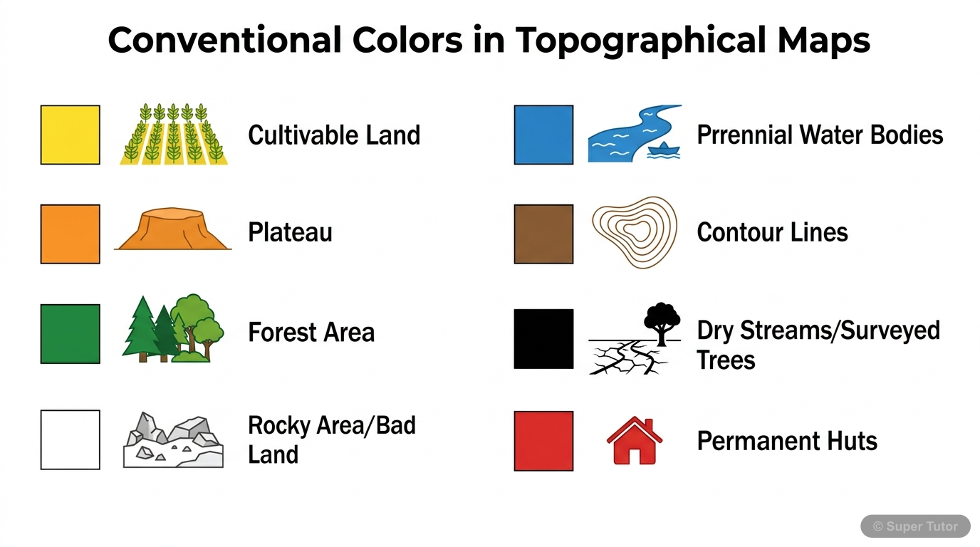
One of 5 illustrations for Representation of Geographical Features in Super Tutor — alongside flashcards, concept maps and practice questions.
What is a topographical map?
Answer
A topographical map is a detailed and accurate graphic representation of features that appear on the Earth's surface. It shows both natural features like hills and rivers, and man-made features like r…
Why are topographical maps useful?
Answer
Topographical maps are useful for travel, military work, geography study, navigation, and planning by engineers, surveyors, town planners, tourists, geographers, and geologists. They give a clear pict…
Which department prepared topographical maps in India?
Answer
Topographical maps in India were prepared by the Survey of India Department. The Survey of India also developed the Sahyog mobile application for collecting, storing, and sharing ground verified data …
Who was Sir George Everest?
Answer
Sir George Everest was the most famous Surveyor General of India, and Mount Everest was named after him. He is an important historical figure connected with surveying in India.
What do the colours blue, red, and yellow show on a topographical map?
Answer
Blue shows water bodies such as perennial lined wells, perennial streams, lakes, ponds, and other water bodies. Red shows settlements, permanent huts, and cities. Yellow shows cultivable land, plateau…
What do the colours brown, green, white, and black show on a topographical map?
Answer
Brown shows height, relief, and contour lines. Green shows forests or lowland areas. White shows rocky area or badland and uncultivable land. Black shows dry streams and surveyed trees.
What is a grid reference?
Answer
A grid reference is the system used to locate a feature on a topographical map using eastings and northings. It helps find the exact position of natural and man-made features on the map.
From which corner is grid reference reading started?
Answer
The origin for grid reference reading is the South-West corner of the map. Eastings are read first, and then northings are read after that.
+29 more flashcards
Practise AllFrequently Asked Questions
What are the important topics in Representation of Geographical Features for ICSE Class 7 Geography?
How many flashcards are available for Representation of Geographical Features?
How should I revise Representation of Geographical Features for Class 7 exams?
Sources & Official References
Content is aligned to the official syllabus. Refer to the board website for the latest curriculum.
More resources for Representation of Geographical Features
Practice Quiz
Test yourself with a quick quiz
Important Questions
Exam-style questions with answers
Revision Notes
Key points for last-minute revision
Formula Sheet
The chapter's formulas in one place
Chapter Summary
Understand the chapter at a glance
Concept Maps
See how topics connect
Study Plan
Step-by-step plan for this chapter
Syllabus
What topics to cover
For serious students
Get the full Representation of Geographical Features chapter — start free.
Quizzes, flashcards, an AI doubt solver and a study plan for ICSE Class 7 Geography. Free to start, no card needed.