Landforms — Practice Quiz
ICSE · Class 6 · Geography
Try a 4-question quiz on Landforms for ICSE Class 6 Geography: tap an answer to check it and see why. 92 questions in the full chapter test.
Interactive on Super Tutor
Studying Landforms? Get the full interactive chapter.
Quizzes, flashcards, AI doubt-solver and a step-by-step study plan — built for practice quiz and more.
Free trial, no card needed.
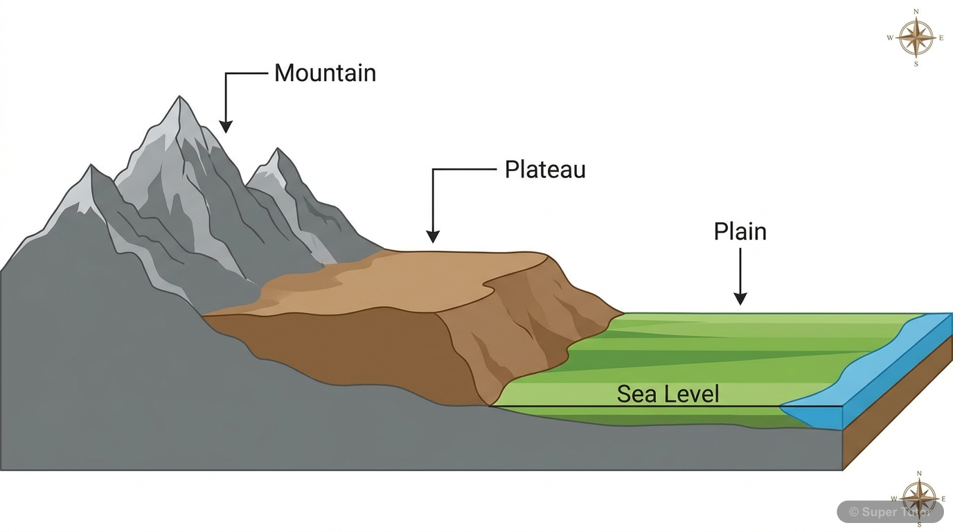
Learn better with visuals Super Tutor pairs illustrations like this with notes and quizzes for Landforms.
Quick Quiz: Landforms
0/4Tap an answer to check it instantly. No sign-up needed for these 4.
What percentage of the Earth's surface is covered by land?
Which of the following processes is an example of an Exogenic (external) process?
Fold mountains are formed when tectonic plates —
Which of the following is an example of a Young Fold Mountain?
Sample Questions
What is the term used for the fracture or crack that occurs in rocks due to tensional forces?
Show answer
Fault
Step 1: Recall the key terms related to earth movements. Step 2: When rocks are subjected to horizontal tensional forces (pulling apart), instead of folding, they crack or fracture. Step 3: This fracture or crack in the rock strata is called a Fault. Step 4: A fold is formed when rocks bend due to compression (not tension). Step 5: An Anticline is the arched/upward part of a fold, and a Syncline is the downward part of a fold. Both anticline and syncline are related to folding, not faulting. Therefore, 'Fault' is the correct answer.
Block mountains are also known as —
Show answer
Horst
Step 1: Recall the German terminology used in geography for landforms formed by faulting. Step 2: When two faults occur side by side, the block between them can either rise or the land on either side can sink. Step 3: If the block between the faults is uplifted (or remains while the surrounding area sinks), it is called a Horst or Block Mountain. Step 4: 'Graben' is the German term for a rift valley — it is the opposite of a Horst (the depressed block, not the uplifted one). Step 5: Anticlines and Synclines are terms for folding, not faulting. Therefore, Horst is the correct answer for block m
The Narmada river in India flows through a rift valley between which two mountain ranges?
Show answer
Vindhya and Satpura
Step 1: Recall the geography of Central India and the Narmada river. Step 2: The Narmada river flows through a rift valley — meaning it occupies a depressed region between two fault zones. Step 3: The Vindhya Range lies to the north of the Narmada river, and the Satpura Range lies to the south. Step 4: This rift valley is similar to the Rhine rift valley in Europe, which lies between the Vosges (France) and the Black Forest (Germany). Step 5: The Himalaya-Karakoram, Aravalli-Western Ghats, and Eastern Ghats options are all incorrect geographic combinations for the Narmada valley.
Which of the following is called the 'Roof of the World'?
Show answer
Tibetan Plateau
Step 1: Recall the famous nickname given to the world's highest plateau. Step 2: The Tibetan Plateau is the highest plateau in the world, located in Asia between the Himalayas and the Kunlun mountains. Step 3: Because of its extraordinary height, it is called the 'Roof of the World'. Step 4: The Deccan Plateau is in India and is a volcanic plateau — not the world's highest. Step 5: The East African Plateau is in Kenya, Tanzania, and Uganda. The Patagonian Plateau is in Argentina. Neither of these is the highest plateau. Therefore, Tibetan Plateau is the correct answer.
+88 more questions on Landforms (ICSE Class 6 Geography)
Practise AllFrequently Asked Questions
What are the important topics in Landforms for ICSE Class 6 Geography?
How many practice questions are there for Landforms?
Sources & Official References
Content is aligned to the official syllabus. Refer to the board website for the latest curriculum.
More resources for Landforms
Important Questions
Exam-style questions with answers
Revision Notes
Key points for last-minute revision
Chapter Summary
Understand the chapter at a glance
Concept Maps
See how topics connect
Study Plan
Step-by-step plan for this chapter
Flashcards
Quick-fire cards for active recall
Syllabus
What topics to cover
For serious students
Get the full Landforms chapter — start free.
Quizzes, flashcards, an AI doubt solver and a study plan for ICSE Class 6 Geography. Free to start, no card needed.