Representation of Geographical Features — Practice Quiz
ICSE · Class 6 · Geography
Try a 4-question quiz on Representation of Geographical Features for ICSE Class 6 Geography: tap an answer to check it and see why.
Interactive on Super Tutor
Studying Representation of Geographical Features? Get the full interactive chapter.
Quizzes, flashcards, AI doubt-solver and a step-by-step study plan — built for practice quiz and more.
Free trial, no card needed.
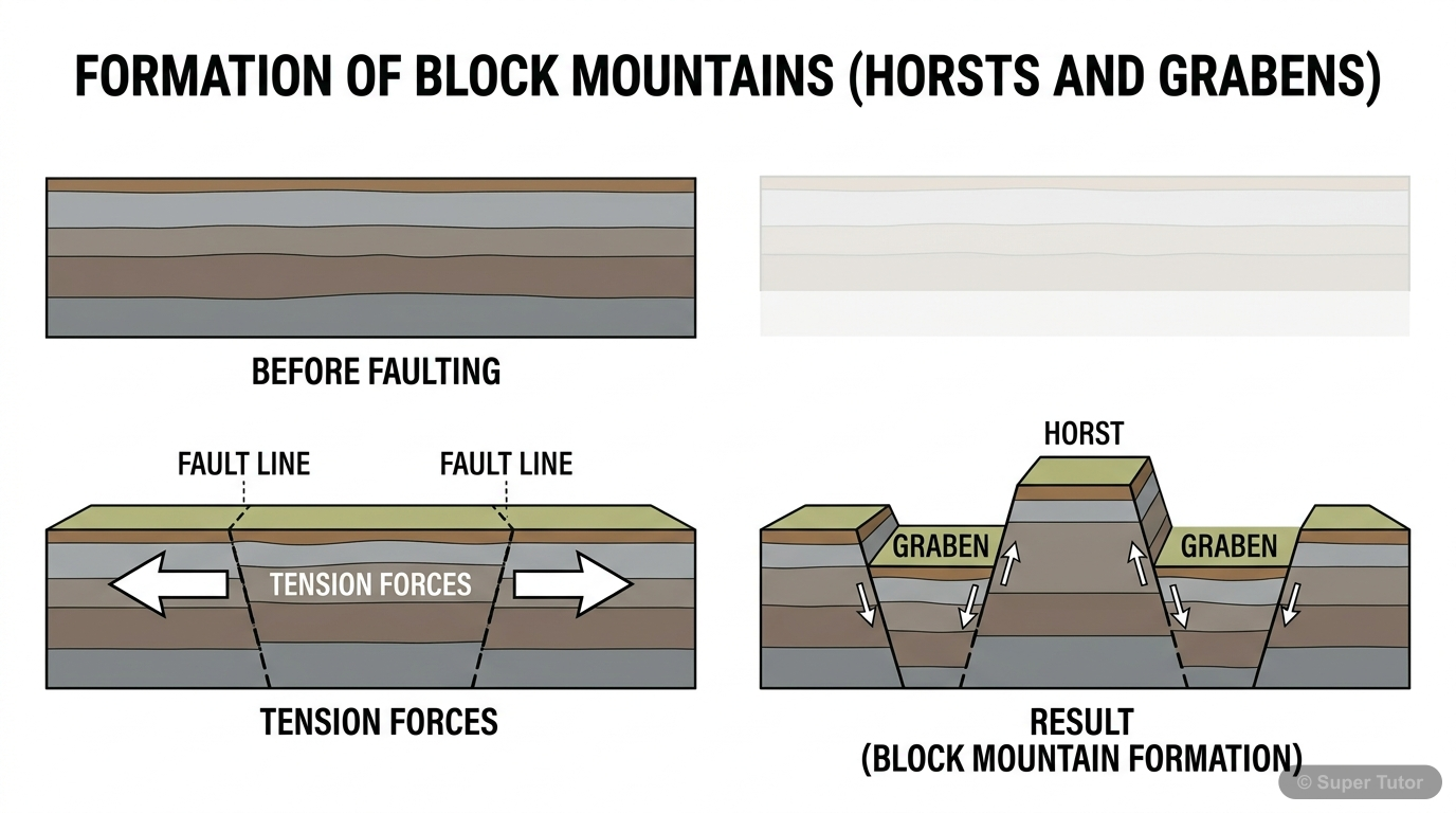
An illustration from Super Tutor's Representation of Geographical Features chapter — alongside flashcards, concept maps and practice questions.
Quick Quiz: Representation of Geographical Features
0/4Tap an answer to check it instantly. No sign-up needed for these 4.
A map has a Representative Fraction (R.F.) of 1:50,000. If two towns are 6 cm apart on the map, what is the actual distance between them on the ground?
Which type of scale is considered universally accepted and can be used by any country in the world without confusion?
Claudius Ptolemy drew the first map of the world in 150 CE. What is the science of map-making called, and who is credited as one of its earliest pioneers?
On a topographical map, which colour is conventionally used to represent contour lines and relief features such as mountains?
Sample Questions
Cadastral maps are a type of large-scale map. Which of the following best describes their PRIMARY use?
Show answer
Recording land ownership, property details, and city surveys
Step 1: Option A describes a Thematic map — showing specific themes like minerals or vegetation. Step 2: Option B describes a Political map — depicting international boundaries and capital cities. Step 3: Option D describes a Topographical map — which shows natural and man-made features and is used for military purposes. Step 4: Cadastral maps are large-scale maps (also called plans) that give full details of properties, buildings, and land. Step 5: They are primarily used for local administration, city surveys, and recording land ownership — making Option C correct.
The word 'meander' is derived from the name of which river, and in which country is that river located?
Show answer
Büyük Menderes river in Turkey
Step 1: A meander is a broad, S-shaped loop or curve formed by a river in flat land during its middle course. Step 2: The River Ganga in India does meander, but the word 'meander' did not originate from it. Step 3: The Missouri river is an example where the Heart river acts as its tributary — not related to the origin of the word. Step 4: The Nile delta is famous for its triangular shape (origin of the word 'delta'), not 'meander'. Step 5: The word 'meander' is specifically derived from the winding pattern of the Büyük Menderes river in Turkey — the correct answer.
Which of the following CORRECTLY distinguishes a tributary from a distributary?
Show answer
A tributary flows into a larger river; a distributary branches off and flows away from the main river
Step 1: A tributary is a smaller stream or river that joins a bigger river — it adds water TO the main river. Step 2: Tributaries help drain the surrounding land and meet the main river at a point called confluence. Step 3: A distributary, on the other hand, is a branch that separates FROM the main river and flows away — it takes water AWAY from the main channel. Step 4: Distributaries are commonly found in river deltas (e.g., River Hugli is a distributary of River Ganga). Step 5: Option A reverses the definitions, Option C is wrong as distributaries don't flow into the main river, and Option
Topographical maps prepared by the Survey of India are drawn to which of the following scales?
Show answer
1:25,000 and 1:50,000
Step 1: Topographical maps show both natural features (hills, valleys) and man-made features (roads, settlements) through careful surveys. Step 2: They are large-scale maps because they show a relatively small area in great detail. Step 3: The Survey of India is the official body responsible for making topographical maps in our country. Step 4: According to the textbook, these maps are specifically drawn to scales of 1:25,000 and 1:50,000. Step 5: The other options (1:10,000, 1:1,00,000, etc.) are not the standard scales used by Survey of India for topographical maps.
+86 more questions on Representation of Geographical Features (ICSE Class 6 Geography)
Practise AllFrequently Asked Questions
What are the important topics in Representation of Geographical Features for ICSE Class 6 Geography?
How many practice questions are there for Representation of Geographical Features?
Sources & Official References
Content is aligned to the official syllabus. Refer to the board website for the latest curriculum.
More resources for Representation of Geographical Features
Important Questions
Exam-style questions with answers
Revision Notes
Key points for last-minute revision
Formula Sheet
The chapter's formulas in one place
Chapter Summary
Understand the chapter at a glance
Concept Maps
See how topics connect
Study Plan
Step-by-step plan for this chapter
Flashcards
Quick-fire cards for active recall
Syllabus
What topics to cover
For serious students
Get the full Representation of Geographical Features chapter — start free.
Quizzes, flashcards, an AI doubt solver and a study plan for ICSE Class 6 Geography. Free to start, no card needed.