Physiography Of India — Concept Maps
NIOS · Class 10 · Social Studies
4 concept maps of Physiography Of India for NIOS Class 10 Social Studies, each also written out as a text outline.
Interactive on Super Tutor
Studying Physiography Of India? Get the full interactive chapter.
Quizzes, flashcards, AI doubt-solver and a step-by-step study plan — built for concept maps and more.
Free trial, no card needed.
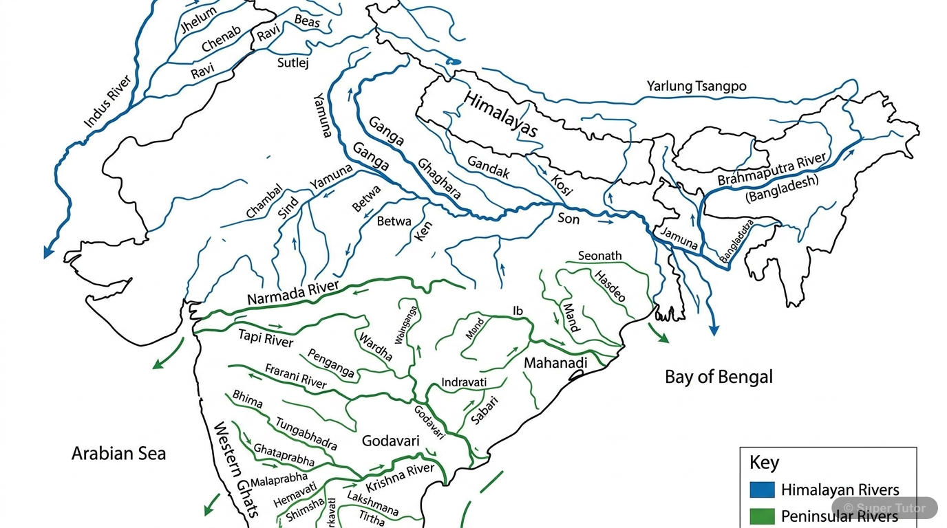
Learn better with visuals Super Tutor pairs illustrations like this with notes and quizzes for Physiography Of India.
Physical Divisions of India - Concept Overview
The map in words
- Physical Divisions of India
- Northern Mountains
- Himalayas
- Greater Himalayas
- Lesser Himalayas
- Siwaliks
- Trans Himalayas
- Purvanchal Hills
- Himalayas
- Northern Plains
- Western Plains
- Ganga Brahmaputra Plains
- Doabs
- Peninsular Plateau
- Central Highlands
- Aravallis
- Malwa Plateau
- Deccan Plateau
- Western Ghats
- Eastern Ghats
- Central Highlands
- Indian Desert
- Thar Desert
- Sand Dunes
- Arid Climate
- Coastal Plains
- Western Coast
- Eastern Coast
- Deltas
- Islands
- Andaman Nicobar
- Lakshadweep
- Northern Mountains
Physiography of India - Complete Overview
The map in words
- Physiography of India
- Location
- Absolute Location
- Latitude 8°4'N to 37°6'N
- Longitude 68°7'E to 97°25'E
- Relative Location
- Northern Hemisphere
- Eastern Hemisphere
- Asian Continent
- Standard Meridian
- 82°30'E
- Passes through Mirzapur
- Absolute Location
- Physical Divisions
- Northern Mountains
- Greater Himalayas
- Lesser Himalayas
- Siwaliks
- Trans Himalayas
- Purvanchal Hills
- Northern Plains
- Western Plain
- Ganga Brahmaputra Plain
- Most Fertile Region
- Peninsular Plateau
- Central Highlands
- Deccan Plateau
- Western Ghats
- Eastern Ghats
- Indian Desert
- Thar Desert
- Semi-arid Climate
- Western Rajasthan
- Coastal Plains
- Western Coast
- Eastern Coast
- Wider Eastern Coast
- Islands
- Andaman Nicobar
- Lakshadweep
- Northern Mountains
- Drainage Systems
- Himalayan System
- Perennial Rivers
- Indus Ganga Brahmaputra
- Glacier Fed
- Peninsular System
- Seasonal Rivers
- Eastward Flow
- Rain Fed
- Himalayan System
- Location
India's Physical Divisions - Complete Overview
The map in words
- Physiography of India
- Location and Extent
- Latitudinal Extent
- 8°4'N to 37°6'N
- Longitudinal Extent
- 68°7'E to 97°25'E
- Strategic Position
- Indian Ocean
- Trade Routes
- Latitudinal Extent
- Physical Divisions
- Northern Mountains
- Himalayas
- Greater Himalayas
- Lesser Himalayas
- Siwaliks
- Trans Himalayas
- Purvanchal Hills
- Himalayas
- Northern Plains
- Ganga Plains
- Indus Plains
- Brahmaputra Plains
- Peninsular Plateau
- Central Highlands
- Deccan Plateau
- Western Ghats
- Eastern Ghats
- Indian Desert
- Thar Desert
- Arid Climate
- Coastal Plains
- Western Coast
- Eastern Coast
- Islands
- Andaman Nicobar
- Lakshadweep
- Northern Mountains
- Drainage Systems
- Himalayan Rivers
- Perennial
- Glacier Fed
- Peninsular Rivers
- Seasonal
- Rain Fed
- Himalayan Rivers
- Location and Extent
Physiography of India
The map in words
- Physiography of India
- Location of India
- States and Union Territories
- Physical Divisions of India
- Northern Mountains
- Himalayas
- Northern Plains
- Peninsular Plateau
- Indian Desert
Explore these maps interactively
Explore DiagramsFrequently Asked Questions
What are the important topics in Physiography Of India for NIOS Class 10 Social Studies?
What do the concept maps for Physiography Of India show?
How should I revise Physiography Of India for the NIOS Class 10 board exam?
Sources & Official References
Content is aligned to the official syllabus. Refer to the board website for the latest curriculum.
More resources for Physiography Of India
Practice Quiz
Test yourself with a quick quiz
Important Questions
Exam-style questions with answers
Revision Notes
Key points for last-minute revision
Chapter Summary
Understand the chapter at a glance
Study Plan
Step-by-step plan for this chapter
Flashcards
Quick-fire cards for active recall
Syllabus
What topics to cover
For serious students
Get the full Physiography Of India chapter — start free.
Quizzes, flashcards, an AI doubt solver and a study plan for NIOS Class 10 Social Studies. Free to start, no card needed.