Interpretation of Topographical Maps-II — Concept Maps
ICSE · Class 10 · Geography
4 concept maps of Interpretation of Topographical Maps-II for ICSE Class 10 Geography, each also written out as a text outline.
Interactive on Super Tutor
Studying Interpretation of Topographical Maps-II? Get the full interactive chapter.
Quizzes, flashcards, AI doubt-solver and a step-by-step study plan — built for concept maps and more.
Free trial, no card needed.
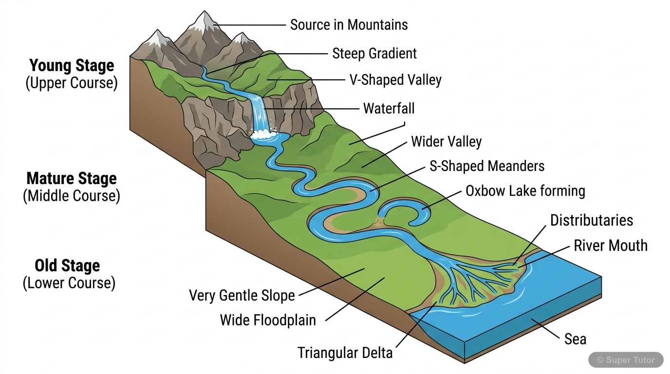
One of 9 illustrations for Interpretation of Topographical Maps-II in Super Tutor — alongside flashcards, concept maps and practice questions.
See them allComplete Concept Map: Interpretation of Topographical Maps
The map in words
- Topographical Map Interpretation
- Grid Reference
- Four Figure Reference
- Six Figure Reference
- Eastings read West to East
- Northings read South to North
- Origin at SW Corner
- Scale
- Representative Fraction RF
- Statement Scale
- Linear Scale
- 2 cm equals 1 km
- Relief Representation
- Contours
- Vertical Interval 20m
- Index Contour every 5th line
- Steep Slope close contours
- Gentle Slope wide contours
- Spot Heights
- Triangulation Points
- Bench Marks
- Hachuring
- Hill Shading
- Form Lines
- Contours
- Landforms by Contours
- Conical Hill
- Ridge or Watershed
- V Shaped Valley
- Escarpment or Cliff
- Water Divide
- Drainage
- Dendritic Pattern
- Trellis Pattern
- Radial Pattern
- River Source and Mouth
- Perennial River
- Dry Streams
- Disappearing Streams
- Directions
- True North
- River Flow Direction
- Right and Left Bank
- Distance and Area
- Straight Line Distance
- Curved Distance by Thread
- Grid Square Area Method
- Features
- Man Made Features
- Roads and Tracks
- Causeways
- Settlements Red
- Wells and Canals
- Natural Features
- Forest Green
- Rivers and Streams
- Broken Ground
- Rocky Areas
- Man Made Features
- Land Use
- Cultivated Land Yellow
- Forest Types
- Open Scrub
- Irrigation Methods
- Settlements
- Nucleated
- Linear
- Scattered
- Growth Factors
- Transport
- Metalled Roads
- Unmetalled Roads
- Pack Tracks
- Cart Tracks
- Grid Reference
Topographical Map Interpretation - Key Topics Overview
The map in words
- Topo Map Interpretation
- Grid Reference
- Four Figure Grid Ref
- Six Figure Grid Ref
- Eastings and Northings
- SW Corner Origin
- Scale and RF
- Representative Fraction
- Linear Scale
- Statement of Scale
- Relief Representation
- Contours
- Steep Slope
- Gentle Slope
- Index Contour
- Spot Heights
- Hachuring
- Bench Marks
- Triangulation
- Contours
- Drainage
- Dendritic Pattern
- Trellis Pattern
- Radial Pattern
- Watershed
- Land Use
- Yellow Cultivable Land
- White Uncultivable
- Green Vegetation
- Blue Water Features
- Settlements
- Nucleated
- Linear
- Scattered
- Grid Reference
Overview of Topographical Map Interpretation
The map in words
- root((Topo Map
- Interpretation))
- Grid Reference
- National Grid System
- Four Figure Reference
- Six Figure Reference
- Eastings and Northings
- Scale
- Statement Scale
- Representative Fraction
- Linear Bar Scale
- Relief Features
- Contours
- Steep Slope
- Gentle Slope
- Index Contour
- Spot Heights
- Bench Marks
- Triangulation Points
- Contours
- Landforms
- Conical Hill
- V Shaped Valley
- Ridge
- Escarpment
- Water Divide
- Drainage
- Dendritic Pattern
- Trellis Pattern
- Radial Pattern
- River Stages
- Land Use
- Cultivated Yellow
- Forest Green
- Uncultivable White
- Irrigation Blue
- Settlements
- Nucleated
- Linear
- Scattered
- Transport
- Metalled Road
- Cart Track
- Causeways
- Grid Reference
Interpretation of topographical maps through grid reference, scale, relief, drainage, land use, transport, directions, distances, area, and map-pointing skills
The map in words
- Interpretation of topographical maps through grid reference, scale, relief, drainage, land use, transport, directions, distances, area, and map-pointing skills
- National Grid Reference
- Scale
- Relief representation
- Contour interpretation
- Directions
- Distance and area measurement
- Drainage pattern
- Man-made and natural features
Explore these maps interactively
Explore DiagramsFrequently Asked Questions
What are the important topics in Interpretation of Topographical Maps-II for ICSE Class 10 Geography?
What do the concept maps for Interpretation of Topographical Maps-II show?
How should I revise Interpretation of Topographical Maps-II for the ICSE Class 10 board exam?
Sources & Official References
Content is aligned to the official syllabus. Refer to the board website for the latest curriculum.
More resources for Interpretation of Topographical Maps-II
Practice Quiz
Test yourself with a quick quiz
Important Questions
Exam-style questions with answers
Revision Notes
Key points for last-minute revision
Formula Sheet
The chapter's formulas in one place
Chapter Summary
Understand the chapter at a glance
Study Plan
Step-by-step plan for this chapter
Flashcards
Quick-fire cards for active recall
Syllabus
What topics to cover
For serious students
Get the full Interpretation of Topographical Maps-II chapter — start free.
Quizzes, flashcards, an AI doubt solver and a study plan for ICSE Class 10 Geography. Free to start, no card needed.