Location, Extent and Physical Features of India — Concept Maps
ICSE · Class 10 · Geography
4 concept maps of Location, Extent and Physical Features of India for ICSE Class 10 Geography, each also written out as a text outline.
Interactive on Super Tutor
Studying Location, Extent and Physical Features of India? Get the full interactive chapter.
Quizzes, flashcards, AI doubt-solver and a step-by-step study plan — built for concept maps and more.
Free trial, no card needed.
Learn better with visuals Super Tutor pairs illustrations like this with notes and quizzes for Location, Extent and Physical Features of India.
Get startedPhysical Divisions of India — Complete Overview
The map in words
- Physical India
- Himalayan Mountains
- NW Ranges
- Hindukush
- Kunlun
- Karakoram
- Great Himalayan Arc
- Himadri
- Middle Himalayas
- Shivalik
- Purvanchal NE
- Patkai Bum
- Naga Hills
- Mizo Hills
- NW Ranges
- Great Northern Plain
- Rajasthan Plain
- Indus Punjab Haryana Plain
- Ganga Plain
- Brahmaputra Plain
- Peninsular Plateau
- Triangular Shape
- Apex at Kanyakumari
- Coastal Plains
- West Coast Estuaries
- East Coast Deltas
- 6000 km length
- Islands
- Andaman Nicobar
- Lakshadweep
- Sri Lanka
- Himalayan Mountains
Correct vs Incorrect Understanding: Key Facts About India
The map in words
- India Geography Key Facts
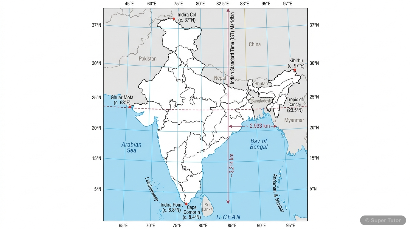
- Latitudinal vs Longitudinal Extent
- WRONG: Latitudinal extent is greater in km so it is greater in degrees too
- RIGHT: Both extents are equal at approx 30 degrees each
- Indian Standard Time
- WRONG: Based on 82 degrees E meridian
- RIGHT: Based on 82 degrees 30 minutes E through Mirzapur UP
- India as Tropical Country
- WRONG: Half temperate half tropical because Tropic of Cancer divides equally
- RIGHT: Essentially tropical due to Himalayas blocking cold winds and monsoon dominance
- Latitudinal vs Longitudinal Extent
Physical Divisions of India — Overview
The map in words
- Physical India
- Himalayan Mountains
- North-West Range
- Hindukush
- Karakoram
- Kunlun
- Northern Arc
- Himadri Greater Himalayas
- Himachal Lesser Himalayas
- Shivalik Outer Himalayas
- Purvanchal North-East
- Patkai Bum
- Naga Hills
- Mizo Hills
- North-West Range
- Great Northern Plains
- Rajasthan Plain
- Indus Punjab Haryana Plain
- Ganga Plain
- Brahmaputra Plain
- Peninsular Plateau
- Western Ghats
- Eastern Ghats
- Deccan Plateau
- Coastal Plains
- Western Coast Estuaries
- Eastern Coast Deltas
- Islands
- Andaman and Nicobar
- Lakshadweep
- Himalayan Mountains
India's location, extent, neighbours, and physical divisions shape its geography, climate, rivers, and resources
The map in words
- India's location, extent, neighbours, and physical divisions shape its geography, climate, rivers, and resources
- Location and extent
- Standard time
- India and neighbouring countries
- Why India is called tropical
- Physical divisions of India
- Himalayan Mountains
- North-West Range
- Northern Arc
Explore these maps interactively
Explore DiagramsFrequently Asked Questions
What are the important topics in Location, Extent and Physical Features of India for ICSE Class 10 Geography?
What do the concept maps for Location, Extent and Physical Features of India show?
How should I revise Location, Extent and Physical Features of India for the ICSE Class 10 board exam?
Sources & Official References
Content is aligned to the official syllabus. Refer to the board website for the latest curriculum.
More resources for Location, Extent and Physical Features of India
Practice Quiz
Test yourself with a quick quiz
Important Questions
Exam-style questions with answers
Revision Notes
Key points for last-minute revision
Chapter Summary
Understand the chapter at a glance
Study Plan
Step-by-step plan for this chapter
Flashcards
Quick-fire cards for active recall
Syllabus
What topics to cover
For serious students
Get the full Location, Extent and Physical Features of India chapter — start free.
Quizzes, flashcards, an AI doubt solver and a study plan for ICSE Class 10 Geography. Free to start, no card needed.