Location, Extent and Physical Features of India — Practice Quiz
ICSE · Class 10 · Geography
Try a 4-question quiz on Location, Extent and Physical Features of India for ICSE Class 10 Geography: tap an answer to check it and see why.
Interactive on Super Tutor
Studying Location, Extent and Physical Features of India? Get the full interactive chapter.
Quizzes, flashcards, AI doubt-solver and a step-by-step study plan — built for practice quiz and more.
Free trial, no card needed.
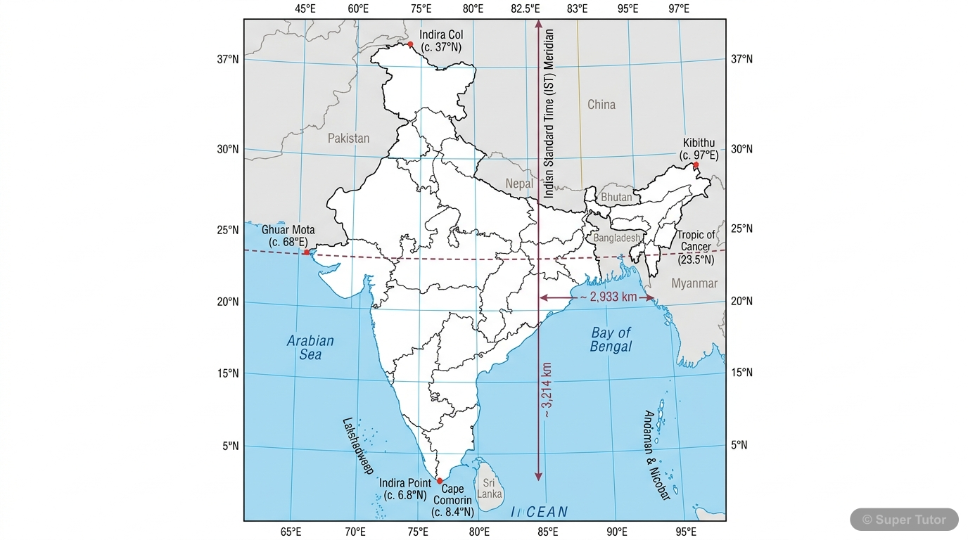
Learn better with visuals Super Tutor pairs illustrations like this with notes and quizzes for Location, Extent and Physical Features of India.
Get startedQuick Quiz: Location, Extent and Physical Features of India
0/4Tap an answer to check it instantly. No sign-up needed for these 4.
What is the latitudinal extent of India?
Which line of latitude divides India into two halves?
What is the area of India?
Which mountain range forms India's northern boundary?
Sample Questions
Which countries share land borders with India? (Select all correct answers)
Show answer
China, Pakistan, Nepal, Bhutan
The chapter states that China and Nepal are immediate neighbours along the northern boundary, Bhutan lies east of Nepal across Sikkim, and Pakistan is India's immediate neighbour to the west. Sri Lanka is a separate island country across the sea, not a land-bordering country. Therefore, the land borders are with China, Pakistan, Nepal, and Bhutan.
Which are the major physical divisions of India? (Select all correct answers)
Show answer
The Himalayan Mountains, The Great Plains, The Peninsular Plateau, The Coastal Plains, The Islands
India has five major physical divisions: Himalayan Mountains, Great Plains, Peninsular Plateau, Coastal Plains, and Islands.
From which longitude is Indian Standard Time calculated?
Show answer
82½°E
Indian Standard Time (IST) is calculated from the standard meridian of 82½°E longitude, which passes through Mirzapur near Allahabad. This meridian was chosen because it passes roughly through the centre of India, and IST is fixed as 5½ hours ahead of Greenwich Mean Time. The other longitudes listed do not correspond to India's standard meridian.
The Peninsular Plateau is triangular in shape.
Show answer
True
The Peninsular Plateau is indeed triangular in shape, with its base along the southern edge of the Great Plains and its apex at Kanyakumari.
+38 more questions on Location, Extent and Physical Features of India (ICSE Class 10 Geography)
Practise AllFrequently Asked Questions
What are the important topics in Location, Extent and Physical Features of India for ICSE Class 10 Geography?
How many practice questions are there for Location, Extent and Physical Features of India?
Sources & Official References
Content is aligned to the official syllabus. Refer to the board website for the latest curriculum.
More resources for Location, Extent and Physical Features of India
Important Questions
Exam-style questions with answers
Revision Notes
Key points for last-minute revision
Chapter Summary
Understand the chapter at a glance
Concept Maps
See how topics connect
Study Plan
Step-by-step plan for this chapter
Flashcards
Quick-fire cards for active recall
Syllabus
What topics to cover
For serious students
Get the full Location, Extent and Physical Features of India chapter — start free.
Quizzes, flashcards, an AI doubt solver and a study plan for ICSE Class 10 Geography. Free to start, no card needed.