Representation of Geographical Features — Important Questions
ICSE · Class 6 · Geography
90 important questions from Representation of Geographical Features for ICSE Class 6 Geography, with answers. Part of the ICSE Class 6 Geography syllabus.
Interactive on Super Tutor
Studying Representation of Geographical Features? Get the full interactive chapter.
Quizzes, flashcards, AI doubt-solver and a step-by-step study plan — built for important questions and more.
Free trial, no card needed.
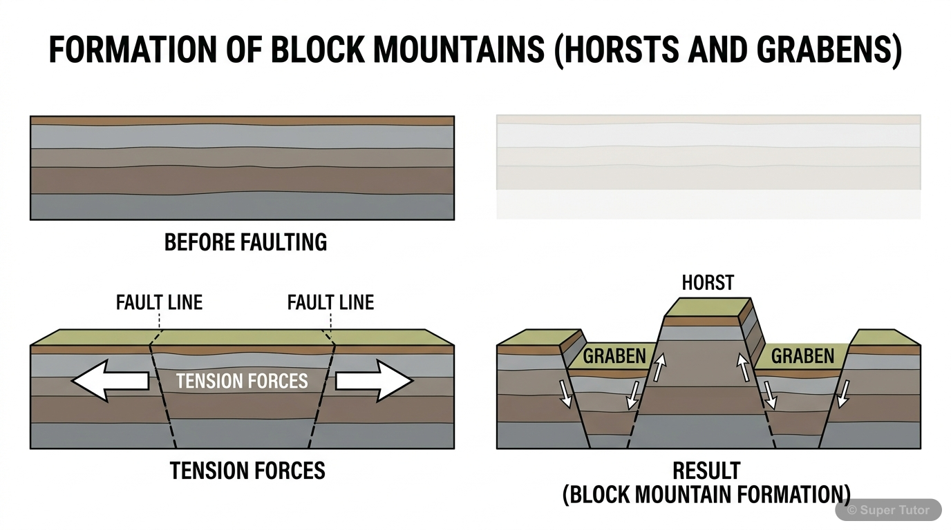
An illustration from Super Tutor's Representation of Geographical Features chapter — alongside flashcards, concept maps and practice questions.
Important Questions from Representation of Geographical Features
Cadastral maps are a type of large-scale map. Which of the following best describes their PRIMARY use?
Show answer
Recording land ownership, property details, and city surveys
Step 1: Option A describes a Thematic map — showing specific themes like minerals or vegetation. Step 2: Option B describes a Political map — depicting international boundaries and capital cities. Step 3: Option D describes a Topographical map — which shows natural and man-made features and is used for military purposes. Step 4: Cadastral maps are large-scale maps (also called plans) that give full details of properties, buildings, and land. Step 5: They are primarily used for local administration, city surveys, and recording land ownership — making Option C correct.
The word 'meander' is derived from the name of which river, and in which country is that river located?
Show answer
Büyük Menderes river in Turkey
Step 1: A meander is a broad, S-shaped loop or curve formed by a river in flat land during its middle course. Step 2: The River Ganga in India does meander, but the word 'meander' did not originate from it. Step 3: The Missouri river is an example where the Heart river acts as its tributary — not related to the origin of the word. Step 4: The Nile delta is famous for its triangular shape (origin of the word 'delta'), not 'meander'. Step 5: The word 'meander' is specifically derived from the winding pattern of the Büyük Menderes river in Turkey — the correct answer.
Which of the following CORRECTLY distinguishes a tributary from a distributary?
Show answer
A tributary flows into a larger river; a distributary branches off and flows away from the main river
Step 1: A tributary is a smaller stream or river that joins a bigger river — it adds water TO the main river. Step 2: Tributaries help drain the surrounding land and meet the main river at a point called confluence. Step 3: A distributary, on the other hand, is a branch that separates FROM the main river and flows away — it takes water AWAY from the main channel. Step 4: Distributaries are commonly found in river deltas (e.g., River Hugli is a distributary of River Ganga). Step 5: Option A reverses the definitions, Option C is wrong as distributaries don't flow into the main river, and Option
Topographical maps prepared by the Survey of India are drawn to which of the following scales?
Show answer
1:25,000 and 1:50,000
Step 1: Topographical maps show both natural features (hills, valleys) and man-made features (roads, settlements) through careful surveys. Step 2: They are large-scale maps because they show a relatively small area in great detail. Step 3: The Survey of India is the official body responsible for making topographical maps in our country. Step 4: According to the textbook, these maps are specifically drawn to scales of 1:25,000 and 1:50,000. Step 5: The other options (1:10,000, 1:1,00,000, etc.) are not the standard scales used by Survey of India for topographical maps.
+86 more questions on Representation of Geographical Features (ICSE Class 6 Geography)
Practise AllFrequently Asked Questions
What are the important topics in Representation of Geographical Features for ICSE Class 6 Geography?
How many important questions are there in Representation of Geographical Features?
Sources & Official References
Content is aligned to the official syllabus. Refer to the board website for the latest curriculum.
More resources for Representation of Geographical Features
Practice Quiz
Test yourself with a quick quiz
Revision Notes
Key points for last-minute revision
Formula Sheet
The chapter's formulas in one place
Chapter Summary
Understand the chapter at a glance
Concept Maps
See how topics connect
Study Plan
Step-by-step plan for this chapter
Flashcards
Quick-fire cards for active recall
Syllabus
What topics to cover
For serious students
Get the full Representation of Geographical Features chapter — start free.
Quizzes, flashcards, an AI doubt solver and a study plan for ICSE Class 6 Geography. Free to start, no card needed.