Representation of Geographical Features — Chapter Summary
ICSE · Class 6 · Geography
Summary of Representation of Geographical Features for ICSE Class 6 Geography. Part of the ICSE Class 6 Geography syllabus.
Interactive on Super Tutor
Studying Representation of Geographical Features? Get the full interactive chapter.
Quizzes, flashcards, AI doubt-solver and a step-by-step study plan — built for chapter summary and more.
Free trial, no card needed.
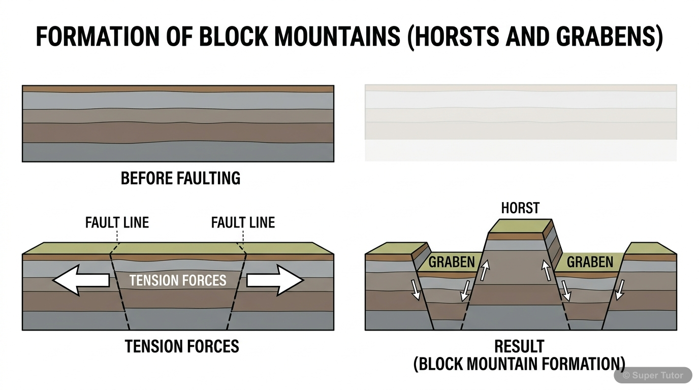
An illustration from Super Tutor's Representation of Geographical Features chapter — alongside flashcards, concept maps and practice questions.
Overview
This chapter introduces students to the essential tools and methods used in Geography to represent the Earth and its features. Since the Earth is too large to study as a whole, geographers use models like globes and maps to understand locations, directions, distances, and physical features. The chap
Key Concepts
A globe is a three
A globe is a three-dimensional spherical model of the Earth. It shows the correct shape, size, and location of continents and oceans. Unlike maps, it
A map is a two
A map is a two-dimensional representation of the Earth or a part of it, drawn to scale on a flat surface. It includes features like rivers, mountains,
Scale shows the relationship between distance
Scale shows the relationship between distance on the map and actual distance on the ground. It can be expressed as a verbal statement, a representativ
Maps use directions like North
Maps use directions like North, South, East, and West (cardinal points) and intermediate directions like NE, NW, SE, SW. A compass helps find these di
Maps use standard symbols (like lines
Maps use standard symbols (like lines for roads, blue for rivers) to represent features. The legend explains what each symbol means.
Learning Objectives
- Differentiate between globe, map, sketch, and plan
- Understand the types and importance of maps
- Learn about scale, directions, and symbols used in maps
- Interpret diagrams of geographical features like rivers, deltas, and mountains
- Apply map-reading skills to real-life situations
Frequently Asked Questions
What are the important topics in Representation of Geographical Features for ICSE Class 6 Geography?
How should I revise Representation of Geographical Features for Class 6 exams?
Sources & Official References
Content is aligned to the official syllabus. Refer to the board website for the latest curriculum.
More resources for Representation of Geographical Features
Practice Quiz
Test yourself with a quick quiz
Important Questions
Exam-style questions with answers
Revision Notes
Key points for last-minute revision
Formula Sheet
The chapter's formulas in one place
Concept Maps
See how topics connect
Study Plan
Step-by-step plan for this chapter
Flashcards
Quick-fire cards for active recall
Syllabus
What topics to cover
For serious students
Get the full Representation of Geographical Features chapter — start free.
Quizzes, flashcards, an AI doubt solver and a study plan for ICSE Class 6 Geography. Free to start, no card needed.