Relief — Chapter Summary
ICSE · Class 12 · Geography
Summary of Relief for ICSE Class 12 Geography. Key concepts: The Himalayas stretch, The Great Himalayas are and This range lies south of.
Interactive on Super Tutor
Studying Relief? Get the full interactive chapter.
Quizzes, flashcards, AI doubt-solver and a step-by-step study plan — built for chapter summary and more.
Free trial, no card needed.
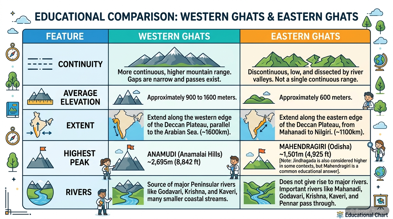
An illustration from Super Tutor's Relief chapter — alongside flashcards, concept maps and practice questions.
Overview
India shows a wide variety of relief features, including young fold mountains, vast plains, old plateaus, coastal strips, and islands. This diversity shapes climate, rivers, agriculture, transport, settlement, industry, and tourism. The main relief divisions are the Himalayan Mountain Complex, the I
Key Concepts
The Himalayas stretch for about 2
The Himalayas stretch for about 2,400 km from the Indus in the west to the Brahmaputra in the east. The average width is 160 to 400 km. They are not a
The Great Himalayas are the highest
The Great Himalayas are the highest and northernmost range. They remain snow-covered throughout the year. Their average altitude exceeds 6,000 metres
This range lies south of
This range lies south of the Great Himalayas. Its height ranges from 3,700 to 4,500 metres and its average width is about 80 km. Important branches in
The southernmost Himalayan range is
The southernmost Himalayan range is the Shiwalik Range. Its height varies from 900 to 1,200 metres and its width from 10 to 50 km. Longitudinal valley
The Karakoram Range lies to
The Karakoram Range lies to the north-east of Ladakh. Its average altitude is 6,000 metres. It contains K2 or Gadwin Austin, which is 8,611 metres hig
Learning Objectives
- Identify the major relief divisions of India.
- Describe the three parallel ranges of the Himalayas and their main features.
- Explain the relief features of the northern plains such as Bhabar, Tarai, Bhangar, Khadar, Bhur, and Barind.
- Understand the regional divisions and importance of the Great Indian Desert and the Punjab-Ganga-Brahmaputra plains.
- Describe the Malwa, Deccan, and Chhotanagpur plateaus and their physical characteristics.
Frequently Asked Questions
What are the important topics in Relief for ICSE Class 12 Geography?
How should I revise Relief for the ICSE Class 12 board exam?
Sources & Official References
Content is aligned to the official syllabus. Refer to the board website for the latest curriculum.
More resources for Relief
For serious students
Get the full Relief chapter — start free.
Quizzes, flashcards, an AI doubt solver and a study plan for ICSE Class 12 Geography. Free to start, no card needed.