Interpretation of Topographical Maps-I — Syllabus
ICSE · Class 10 · Geography
What Interpretation of Topographical Maps-I covers in ICSE Class 10 Geography: 4 topics, for the 2026-27 session.
Interactive on Super Tutor
Studying Interpretation of Topographical Maps-I? Get the full interactive chapter.
Quizzes, flashcards, AI doubt-solver and a step-by-step study plan — built for syllabus and more.
Free trial, no card needed.
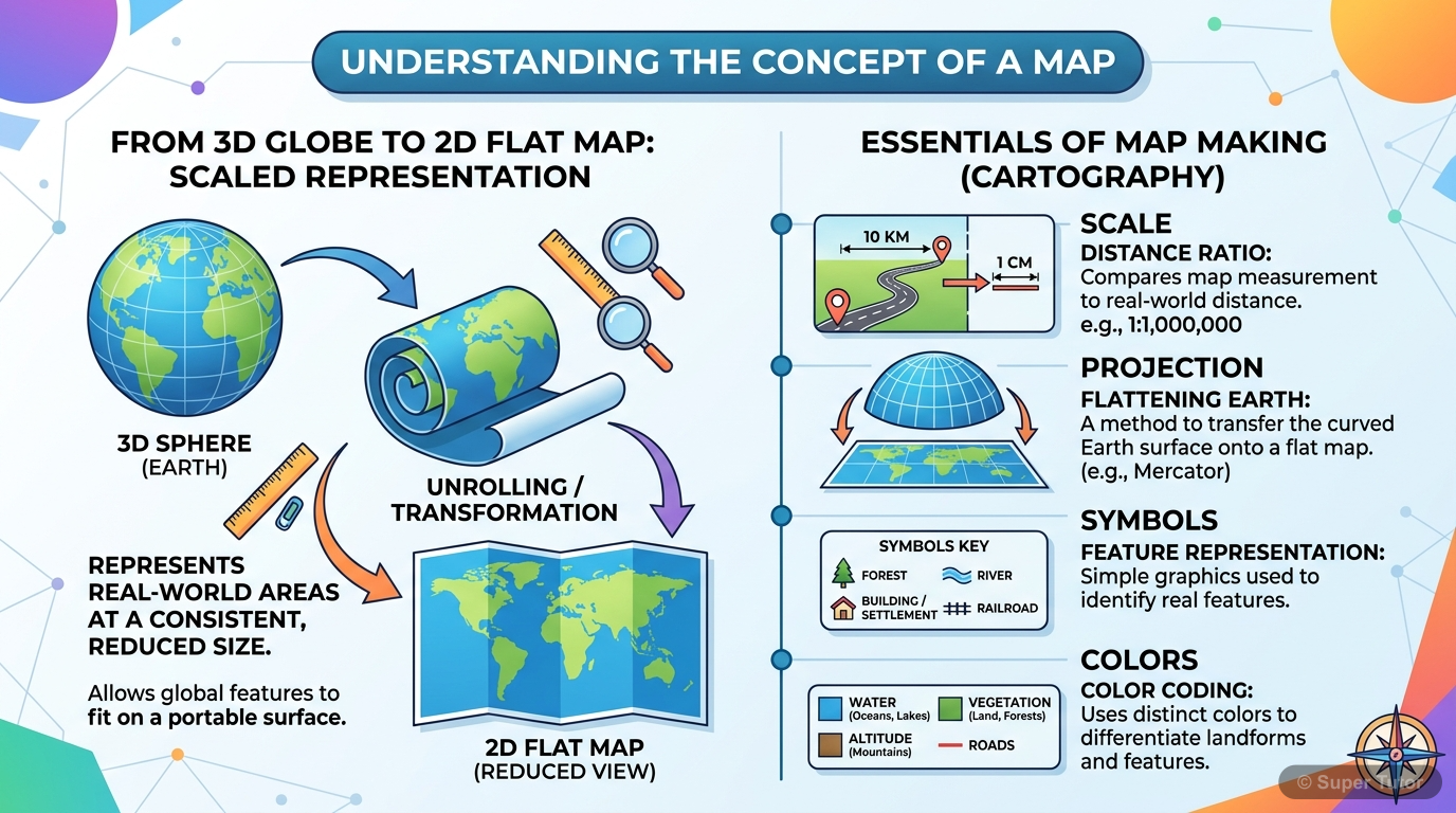
One of 9 illustrations for Interpretation of Topographical Maps-I in Super Tutor — alongside flashcards, concept maps and practice questions.
See them allTopics in Interpretation of Topographical Maps-I
1. Concept of a Map and Scale
- A map is a two dimensional scaled representation of the Earth's surface or a part of it, showing physical and human-made features through a combination of symbols lines and colours.
- A map is a simplified, two-dimensional depiction of the whole or part of the three-dimensional earth, drawn using a system of map projections.
- Maps are selective, symbolised and generalised representations of the earth's surface on a plane surface at a reduced scale.
2. Topographical Maps and Survey of India
- Topographical or Ordnance Survey Maps were first made for the British Army around 1765 under Maj. General Roy.
- The Survey of India Department was established by the British in India in 1767.
- Major James Renell was the first Surveyor General of India.
3. Conventional Colours and Signs
- Conventional colours are accepted all over the world and help in reading topographical maps correctly.
- Yellow colour stands for cultivable land.
- Orange colour stands for plateau.
4. Open Series Maps and Sheet Numbering
- Open Series Maps were introduced as per the National Map Policy of 2005 by Survey of India.
- They replaced the previous India and Adjacent Countries numbering system.
- The map series is based on Universal Transverse Mercator projection on WGS-1984 datum.
Key Concepts
Central concept: Topographical map interpretation
Work through every topic in Interpretation of Topographical Maps-I with notes and quizzes
Start This ChapterFrequently Asked Questions
What are the important topics in Interpretation of Topographical Maps-I for ICSE Class 10 Geography?
How should I revise Interpretation of Topographical Maps-I for the ICSE Class 10 board exam?
Sources & Official References
Content is aligned to the official syllabus. Refer to the board website for the latest curriculum.
More resources for Interpretation of Topographical Maps-I
Practice Quiz
Test yourself with a quick quiz
Important Questions
Exam-style questions with answers
Revision Notes
Key points for last-minute revision
Formula Sheet
The chapter's formulas in one place
Chapter Summary
Understand the chapter at a glance
Concept Maps
See how topics connect
Study Plan
Step-by-step plan for this chapter
Flashcards
Quick-fire cards for active recall
For serious students
Get the full Interpretation of Topographical Maps-I chapter — start free.
Quizzes, flashcards, an AI doubt solver and a study plan for ICSE Class 10 Geography. Free to start, no card needed.