Interpretation of Topographical Maps-I — Chapter Summary
ICSE · Class 10 · Geography
Summary of Interpretation of Topographical Maps-I for ICSE Class 10 Geography. Part of the ICSE Class 10 Geography syllabus.
Interactive on Super Tutor
Studying Interpretation of Topographical Maps-I? Get the full interactive chapter.
Quizzes, flashcards, AI doubt-solver and a step-by-step study plan — built for chapter summary and more.
Free trial, no card needed.
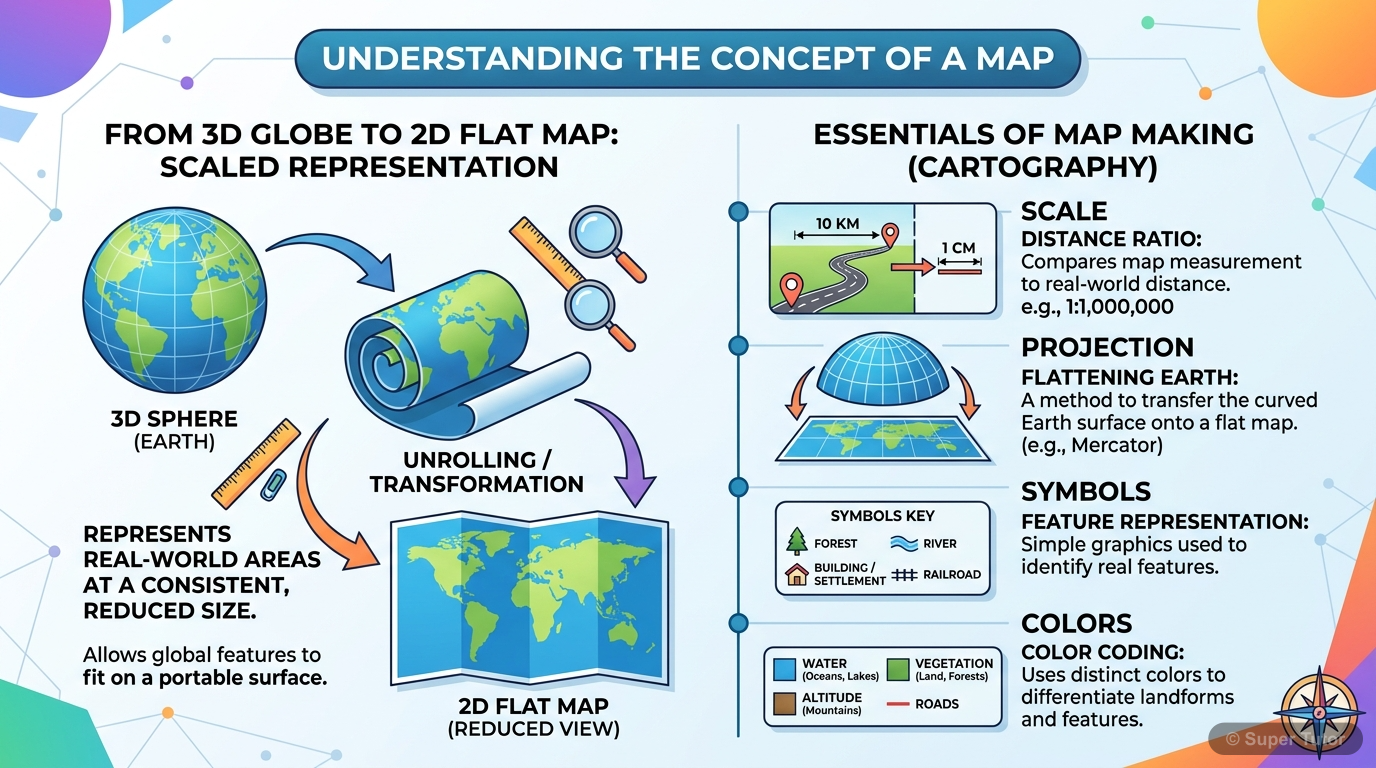
One of 9 illustrations for Interpretation of Topographical Maps-I in Super Tutor — alongside flashcards, concept maps and practice questions.
See them allOverview
A map is a simplified, two-dimensional depiction of the whole or part of the three-dimensional earth, drawn using a system of map projections. A topographical or ordnance survey map, also called a topo sheet, shows both natural features such as relief, drainage and vegetation, and man-made features
Key Concepts
A map is a two dimensional
A map is a two dimensional scaled representation of the Earth's surface or a part of it, showing physical and human-made features through a combinatio
Scale is the ratio between
Scale is the ratio between a distance measured on a map and the corresponding distance on the ground, shown in the same unit. Large scale maps show a
A topographical or ordnance survey map
A topographical or ordnance survey map portrays both natural and man-made features of the ground as much as the scale allows. It includes relief, drai
The Survey of India is
The Survey of India is the national survey and mapping organization of the country under the Ministry of Science and Technology. Its work includes top
Topographical maps use standard colours
Topographical maps use standard colours to show features: yellow for cultivable land, orange for plateau, green for forest area, white for rocky or ba
Learning Objectives
- Understand the concept and definition of a map
- Distinguish between large scale and small scale maps
- Identify the features shown on topographical or ordnance survey maps
- Recognise the role and history of the Survey of India
- Use conventional colours and symbols to interpret map features
Frequently Asked Questions
What are the important topics in Interpretation of Topographical Maps-I for ICSE Class 10 Geography?
How should I revise Interpretation of Topographical Maps-I for the ICSE Class 10 board exam?
Sources & Official References
Content is aligned to the official syllabus. Refer to the board website for the latest curriculum.
More resources for Interpretation of Topographical Maps-I
Practice Quiz
Test yourself with a quick quiz
Important Questions
Exam-style questions with answers
Revision Notes
Key points for last-minute revision
Formula Sheet
The chapter's formulas in one place
Concept Maps
See how topics connect
Study Plan
Step-by-step plan for this chapter
Flashcards
Quick-fire cards for active recall
Syllabus
What topics to cover
For serious students
Get the full Interpretation of Topographical Maps-I chapter — start free.
Quizzes, flashcards, an AI doubt solver and a study plan for ICSE Class 10 Geography. Free to start, no card needed.